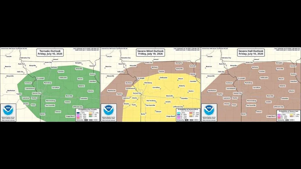
Tornado Warning Issued for Kansas City
Residents across the Kansas City metropolitan area are being urged to take cover immediately following a tornado warning issued by the National Weather Service (NWS) today. Meteorologists identified a severe storm system exhibiting strong rotation moving through the region, prompting an emergency alert for Jackson County and surrounding neighborhoods. This weather event is rapidly evolving, and authorities are advising all citizens to prioritize safety as the storm tracks toward populated areas.
Understanding the severity of a tornado in Kansas City requires immediate attention to local weather alerts. This report provides the latest updates, safety guidance, and context regarding the ongoing weather emergency as emergency management teams monitor the storm’s path.
What Happened
Earlier today, the NWS radar detected a signature indicating potential tornado development within a line of supercell thunderstorms. These storms have brought heavy rainfall, frequent lightning, and localized damaging winds to the area. The initial warning was triggered when radar showed a concentrated area of rotation consistent with a developing funnel cloud. While confirmed sightings on the ground remain fluid, the atmospheric conditions present a significant risk of sudden severe weather impact to homes and infrastructure throughout the Kansas City corridor.
What’s Happening Now/Next
Emergency sirens have been activated across Jackson County to alert residents to the immediate danger. Local authorities are coordinating with the NWS to track the cell as it shifts intensity and direction. Emergency responders are currently on standby for any reports of structural damage or power outages caused by the high winds. Meteorologists warn that the threat could persist for several hours, with potential for additional watches or warnings as secondary storms move into the Kansas City area.
What This Means For You
For individuals in the path of the storm, this alert means your routine must be interrupted for safety. You may experience localized power outages, flash flooding, or debris hazards on roads. Commuters are advised to avoid travel during the active warning window. If you are in a building, move to the lowest level or an interior room away from windows and doors. Staying informed through battery-powered radios or cellular alerts is critical while the situation remains volatile.
What You Can Do Now
- Seek Shelter: Get to a basement or a small interior room on the lowest floor.
- Avoid Windows: Stay away from glass, exterior walls, and heavy furniture.
- Monitor Updates: Keep a mobile device close for incoming emergency alerts from the NWS.
- Stay Off Roads: Do not attempt to drive through flooded areas or into the path of a storm.
Closing
The situation involving the tornado in Kansas City remains dynamic and dangerous. Please heed all warnings from local officials and monitor official weather channels for the latest information. We will continue to provide updates as soon as more data becomes available from the National Weather Service.